


 24/7 Emergency Service
Supercells
1/10/2020 (Permalink)
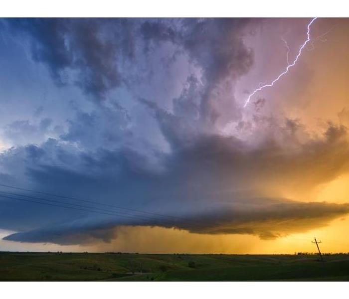 Supercell capable of producing damaging winds, hail and tornadoes
Supercells are storms that contain updrafts that rotate about a vertical axis. This rotation is derived from shear in the environmental wind field surrounding the storm as it begins to grow. Supercells often produce damaging wind, large hail and tornadoes. Most of the strongest tornadoes are associated with supercells.
A supercell requires several very unique factors coming together in order to see one form. All thunderstorms require moisture, instability and lift to form. Supercells require the same ingredients but must have wind shear as well to form.
- Moisture: adequate amount of moisture has to present in order for a supercell to form. On the Plains, the base line for good supercell thunderstorms is usually 50F. For supercells to be tornadic, the base line figures are usually dew points of 55F on the High Plains and 60F for the lower plains. These vary setup to setup though.
- Moisture:Supercells require adequate moisture to be present in order to form. Instability and Lift: Unstable air is air that tends to rise when it is lifted. For air to rise, it has to be hotter than the air surrounding it, think about the old saying ‘hot air rises’. That saying is true for the atmosphere as well. Unstable air occurs when the air at the surface is warmed beneath cooler temps aloft. The faster the air tends to rise, the more unstable the atmosphere is.
- Wind Shear: Supercells need to have the updraft rotating, this is accomplished through wind shear or wind which veers and speeds up with height.
If a storm that meets these criteria is possible for an area, the Storm Prediction Center will issue a severe thunderstorm watch or a tornado watch. If a storm with these criteria is imminent, your local Weather Service office will issue a severe thunderstorm warning or a tornado warning.
Over time (usually an hour or two), the supercells will completely break down and form into a strong line of thunderstorms. Since supercells usually form in the central Plains during the late afternoon hours, the supercells merge into a line by the late evening and nighttime hours and the line starts to race eastward. This is why parts of the south (especially Arkansas) often see a good portion of their severe weather in the middle of the night.
With the intensity of these storms getting prepared and remaining weather alert can save lives and property. Stay tuned to your local news or NOAA Weather Radio for emergency updates. If you have made outdoor plans move the activities to an inside location.
Make plans to stay with a relative or friend if the structure of your home is not sustainable for high winds. Mobile homes can blow over with high winds. Arrive at your safe place well in advance to avoid being caught in your vehicle. If you are driving pull over and stay in your vehicle. Make sure your emergency flashers are on so are visible.
If your home or business is impacted by storms and emergency service is needed, SERVPRO of the Quad Cities is available 24 hours 7 days a week. Our professionals are trained and equipped to provide your mitigation and restoration needs. Serving our community and restoring loss to your property!